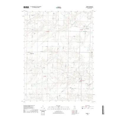
2018 Map of Camden
USGS Topo · Published 2018About this map
The La Moine River winds through the eastern portion of this Schuyler County landscape, anchoring a rural region defined by its historic small settlements and numerous family-named burial grounds. The village of Brooklyn sits near the river's bend in the northeast, while Huntsville and Camden serve as local hubs for the surrounding agricultural community. Genealogists will find a wealth of specific landmarks, including individual markers like Joey Eaton Grave and Pettijohn Grave, alongside established grounds such as West Camden Cem and Brooklyn Cem. The terrain is deeply carved by water, with Little Cedar Cr and Lewis Cr feeding into larger systems, and Croxton Lake providing a distinct hydrological feature in the southwest. A grid of rural routes, including Nubbin Ridge Rd and Blackburn Bottom Rd, provides the backbone for the scattered farmsteads that have shaped this Illinois interior.
Find a feature on this map
74 named features on this map. Tap any name to fly to it.
Don’t see what you’re looking for? This feature index may not catch every label — zoom into the map to look around manually.
Map Details
Editions of this 2018 Camden Map
This is the sole edition of this map. No revisions or reprints were ever made.
Other maps of this area

1912 · Macomb
USGS Topo · 1:62,500

1913 · Colchester
USGS Topo · 1:62,500

1914 · Macomb
USGS Topo · 1:62,500

1923 · Rushville
USGS Topo · 1:62,500

1926 · Rushville
USGS Topo · 1:62,500

1946 · Augusta
USGS Topo · 1:62,500

1949 · Augusta
USGS Topo · 1:62,500

1958 · Burlington
USGS Topo · 1:250,000

1961 · Burlington
USGS Topo · 1:250,000

1963 · Burlington
USGS Topo · 1:250,000