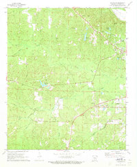
1971 Map of Camden SW
USGS Topo · Published 1973About this map
Camden sits at the eastern edge of this landscape, where the St Louis Southwestern and Missouri Pacific railroads converge near the bottomland of Two Bayou. The terrain to the west is defined by a dense network of creek branches, including Panther Creek, Hale Creek, and Lewis Bayou, interspersed with family-named landmarks and rural burial grounds. Genealogists may find value in the locations of Eternal Rest Cem, Hawkins Cem, and Pleasant Hill Cem, which are scattered among small community centers like Finnswitch.
Find a feature on this map
44 named features on this map. Tap any name to fly to it.
Don’t see what you’re looking for? This feature index may not catch every label — zoom into the map to look around manually.
Map Details
Editions of this 1971 Camden SW Map
2 editions found
Other maps of this area

1901 · Gurdon
USGS Topo · 1:125,000

1903 · Camden
USGS Topo · 1:125,000

1951 · Camden
USGS Topo · 1:24,000

1953 · El Dorado
USGS Topo · 1:250,000

1957 · El Dorado
USGS Topo · 1:250,000

1958 · El Dorado
USGS Topo · 1:250,000

1960 · El Dorado
USGS Topo · 1:250,000

1962 · Louann
USGS Topo · 1:24,000

1962 · Buena Vista
USGS Topo · 1:24,000

1964 · Louann
USGS Topo · 1:62,500