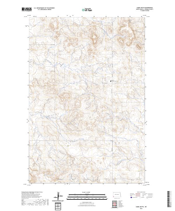
2024 Map of Camel Butte
USGS Topo · Published 2024About this map
Medicine Pole Hills rise as a prominent topographic feature in this corner of Bowman County, where the high plains landscape is carved by several distinct drainages. The Bethany Lutheran Church Cem stands near the intersection of Rhame Rd and 158th Ave SW, serving as a vital landmark for local genealogical research and historical community placement. The geography is defined by a network of seasonal watercourses, including Skull Creek, Horse Creek, and Spring Creek, which eventually feed into the North Fork Grand River in the southern portion of the quadrangle. Surface infrastructure like Oil Well Rd hints at the region's energy resources and industrial history. The settlement of Camel Butte is situated near the southern boundary, surrounded by a grid of section lines that reflect the enduring Public Land Survey System structure of the North Dakota prairie.
Find a feature on this map
19 named features on this map. Tap any name to fly to it.
Don’t see what you’re looking for? This feature index may not catch every label — zoom into the map to look around manually.
Map Details
Editions of this 2024 Camel Butte Map
This is the sole edition of this map. No revisions or reprints were ever made.
Other maps of this area

1935 · Buffalo
USGS Topo · 1:125,000

1953 · Dickinson
USGS Topo · 1:250,000

1954 · Lemmon
USGS Topo · 1:250,000

1957 · Dickinson
USGS Topo · 1:250,000

1957 · Lemmon
USGS Topo · 1:250,000

1969 · Ladner NE
USGS Topo · 1:24,000

1969 · Table Mountain
USGS Topo · 1:24,000

1973 · Camel Butte
USGS Topo · 1:24,000
1973 · Rhame SE
USGS Topo · 1:24,000

1973 · Griffin
USGS Topo · 1:24,000