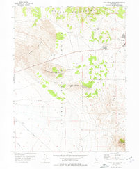
1955 Map of Camels Back Ridge NE
USGS Topo · Published 1977About this map
Dugway Proving Ground dominates this mid-century landscape in the high desert of Tooele County. The terrain is defined by the sweeping Sand Dunes to the west and the prominent peaks of Little Granite Mountain, Little Davis Mountain, and Davis Mtn rising from the basin floor. The map records a transition from traditional desert travel routes, like the Simpson Springs Road and various Jeep Trails, to military-specific infrastructure. Remote operations are evidenced by the Fox Area and Easy Area situated along Stark Road, while a lone Tunnel and scattered Gravel Pits suggest specialized construction or mining activities. The seasonal drainage of Government Creek provides a rare hydrologic marker in this arid expanse, where the northern heights of the Cedar Mountains meet the vast flats of the proving ground.
Find a feature on this map
17 named features on this map. Tap any name to fly to it.
Don’t see what you’re looking for? This feature index may not catch every label — zoom into the map to look around manually.
Map Details
Editions of this 1955 Camels Back Ridge NE Map
2 editions found
Other maps of this area

1885 · Tooele Valley
USGS Topo · 1:250,000

1953 · Tooele
USGS Topo · 1:250,000

1954 · Camels Back Ridge NW
USGS Topo · 1:24,000

1955 · Tabbys Peak SE
USGS Topo · 1:24,000

1955 · Camels Back Ridge SW
USGS Topo · 1:24,000

1955 · Simpson Springs
USGS Topo · 1:24,000

1955 · Indian Peaks
USGS Topo · 1:24,000

1955 · Camels Back Ridge NE
USGS Topo · 1:24,000

1955 · Davis Knolls
USGS Topo · 1:24,000

1955 · Deseret Peak
USGS Topo · 1:62,500