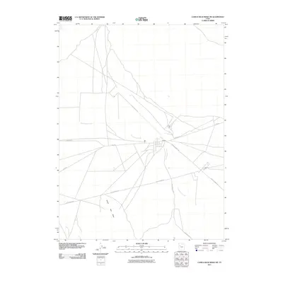
2011 Map of Camels Back Ridge NW
USGS Topo · Published 2011About this map
Government Creek defines the drainage of this arid landscape in Tooele County, as it was recorded in 2011. The map illustrates a strictly managed desert environment dominated by military installations including Able Area, Dog Area, and Charlie Area. These designated zones are integrated into a sparse network of service roads, such as Goodyear Rd and Stark Rd, which cross the open flats. The prominent landform of Camels Back Ridge rises to the southwest, providing a natural topographical anchor against the otherwise linear military and infrastructure developments. Several long-distance routes including Simpson Springs Rd and Peter Charlie Rd converge near the creek, suggesting a hub for regional transit and operations within this controlled territory.
Find a feature on this map
10 named features on this map. Tap any name to fly to it.
Don’t see what you’re looking for? This feature index may not catch every label — zoom into the map to look around manually.
Map Details
Editions of this 2011 Camels Back Ridge NW Map
This is the sole edition of this map. No revisions or reprints were ever made.
Other maps of this area

1885 · Tooele Valley
USGS Topo · 1:250,000

1953 · Tooele
USGS Topo · 1:250,000

1954 · Dugway Proving Ground SE
USGS Topo · 1:24,000

1954 · Dugway Proving Ground NE
USGS Topo · 1:24,000

1954 · Camels Back Ridge NW
USGS Topo · 1:24,000

1955 · Tabbys Peak SE
USGS Topo · 1:24,000

1955 · Camels Back Ridge SW
USGS Topo · 1:24,000

1955 · Simpson Springs
USGS Topo · 1:24,000

1955 · Camels Back Ridge NE
USGS Topo · 1:24,000

1955 · Wig Mtn
USGS Topo · 1:24,000