
1954 Map of Dugway Proving Ground NE
USGS Topo · Published 1956About this map
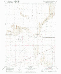
Sand Dunes dominate this arid landscape within the northeastern corner of the Dugway Proving Ground military reservation. This 1954 survey shows a remote installation characterized by a sparse road network and minimal permanent development, reflecting its role as a restricted testing and training site during the Cold War. The Baker Area serves as a localized point of activity within the proving ground, situated along the primary east-west corridor of Goodyear Road. To the south, Stark Road cuts a straight path across the desert floor toward the mountains beyond. The map provides precise elevation data through numerous benchmarks like BM 4307 and BM 4319, capturing the subtle topography of the Great Salt Lake Desert before modern expansions altered these specific range coordinates.
Find a feature on this map
13 named features on this map. Tap any name to fly to it.
Don’t see what you’re looking for? This feature index may not catch every label — zoom into the map to look around manually.
Map Details
Editions of this 1954 Dugway Proving Ground NE Map
4 editions found
Other maps of this area

1885 · Tooele Valley
USGS Topo · 1:250,000

1953 · Tooele
USGS Topo · 1:250,000

1954 · Wig Mtn SW
USGS Topo · 1:24,000

1954 · Dugway Proving Ground SE
USGS Topo · 1:24,000

1954 · Dugway Proving Ground SW
USGS Topo · 1:24,000

1954 · Camels Back Ridge NW
USGS Topo · 1:24,000

1954 · Dugway Proving Ground NW
USGS Topo · 1:24,000

1955 · Camels Back Ridge SW
USGS Topo · 1:24,000

1955 · Wig Mtn
USGS Topo · 1:24,000

1955 · Tabbys Peak SW
USGS Topo · 1:24,000