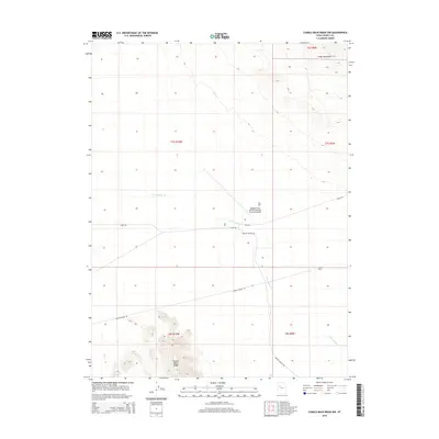
2014 Map of Camels Back Ridge NW
USGS Topo · Published 2014About this map
Michael Army Airfield (Dugway Proving Ground) dominates the central geography of this high-desert landscape in Tooele County, reflecting the deep integration of military operations within the Great Salt Lake Desert. The airfield and its associated operational zones, including Able Area, Dog Area, and Charlie Area, are positioned along the drainage of Government Cr. This ephemeral waterway flows between the southern terminus of the Cedar Mountains to the north and the distinct elevation of Camels Back Ridge in the south. The transportation network consists of straight, functional routes like Stark Rd and Peter Charlie Rd, which serve the expansive military testing and training grounds. This survey captures a specialized landscape where natural desert landforms are partitioned for national defense purposes.
Find a feature on this map
17 named features on this map. Tap any name to fly to it.
Don’t see what you’re looking for? This feature index may not catch every label — zoom into the map to look around manually.
Map Details
Editions of this 2014 Camels Back Ridge NW Map
This is the sole edition of this map. No revisions or reprints were ever made.
Other maps of this area

1885 · Tooele Valley
USGS Topo · 1:250,000

1953 · Tooele
USGS Topo · 1:250,000

1954 · Dugway Proving Ground SE
USGS Topo · 1:24,000

1954 · Dugway Proving Ground NE
USGS Topo · 1:24,000

1954 · Camels Back Ridge NW
USGS Topo · 1:24,000

1955 · Tabbys Peak SE
USGS Topo · 1:24,000

1955 · Camels Back Ridge SW
USGS Topo · 1:24,000

1955 · Simpson Springs
USGS Topo · 1:24,000

1955 · Camels Back Ridge NE
USGS Topo · 1:24,000

1955 · Wig Mtn
USGS Topo · 1:24,000