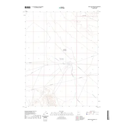
2023 Map of Camels Back Ridge NW
USGS Topo · Published 2023About this map
Michael Army Airfield (Dugway Proving Ground) and the West Desert Test Center dominate this specialized landscape within the Tooele County desert. This modern survey illustrates the highly structured grid of a critical military installation, where infrastructure and remote testing facilities are carved into the arid flats. The map serves as a contemporary record of national defense activity, documenting the precise layout of airfields and test centers that have defined this region's purpose for decades.
Find a feature on this map
12 named features on this map. Tap any name to fly to it.
Don’t see what you’re looking for? This feature index may not catch every label — zoom into the map to look around manually.
Map Details
Editions of this 2023 Camels Back Ridge NW Map
This is the sole edition of this map. No revisions or reprints were ever made.
Other maps of this area

1885 · Tooele Valley
USGS Topo · 1:250,000

1953 · Tooele
USGS Topo · 1:250,000

1954 · Dugway Proving Ground SE
USGS Topo · 1:24,000

1954 · Dugway Proving Ground NE
USGS Topo · 1:24,000

1954 · Camels Back Ridge NW
USGS Topo · 1:24,000

1955 · Tabbys Peak SE
USGS Topo · 1:24,000

1955 · Camels Back Ridge SW
USGS Topo · 1:24,000

1955 · Simpson Springs
USGS Topo · 1:24,000

1955 · Camels Back Ridge NE
USGS Topo · 1:24,000

1955 · Wig Mtn
USGS Topo · 1:24,000