
1950 Map of Cameron
USGS Topo · Published 1954About this map
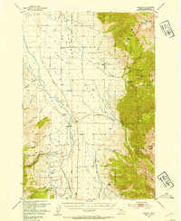
Madison Range peaks dominate the eastern horizon of this 1950s survey, rising sharply above the expansive Cameron Bench. This landscape is defined by its mid-century ranching and resource economy, centered around the settlement of Cameron and numerous family holdings such as Storey Ranch, Olsen Ranch, and Armitage Ranch. The Madison River flows through the center of the quadrangle, crossed by the Mc Ateee Bridge, while a network of irrigation ditches like the Cummings Ditch supports the valley floor. High in the mountains, the extractive history of the region is visible at the Mountain Talc Mine and Ruby Mine, while the timber industry is represented by the Krauss Sawmill. The presence of the Beaverhead National Forest is marked by the Bear Creek Ranger Station and Wall Creek Ranger Station, illustrating the integration of federal land management with local ranching life.
Find a feature on this map
49 named features on this map. Tap any name to fly to it.
Don’t see what you’re looking for? This feature index may not catch every label — zoom into the map to look around manually.
Map Details
Editions of this 1950 Cameron Map
5 editions found
Other maps of this area

1888 · Three Forks
USGS Topo · 1:250,000

1894 · Three Forks
USGS Topo · 1:250,000

1895 · Three Forks
USGS Topo · 1:250,000

1947 · Bozeman
USGS Topo · 1:250,000

1948 · Bozeman
USGS Topo · 1:250,000

1949 · Varney
USGS Topo · 1:62,500

1949 · Ennis
USGS Topo · 1:62,500

1950 · Cliff Lake
USGS Topo · 1:62,500

1950 · Hebgen Dam
USGS Topo · 1:62,500

1950 · Spanish Peaks
USGS Topo · 1:62,500