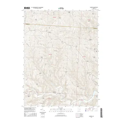
2016 Map of Cameron
USGS Topo · Published 2016About this map
Sunfish Creek and its many tributaries, such as Paine Run and Ackerson Run, define the deeply dissected landscape of Monroe and Belmont Counties. Small settlements including Cameron and Bingham are linked by a complex network of ridge-top roads, reflecting a long-standing settlement pattern where high ground provided the only navigable routes through the steep drainages. The map reveals a high concentration of genealogical resources, particularly family-named cemeteries like Captina Cem, Ruble Cem, and Hartline Cem, which are often located near the crests of prominent landforms like Brock Ridge and Headley Ridge. Landmarks such as the Zion Methodist Cem and the Old Case Cem indicate the community hubs of this rural Appalachian region, while features like Kanzigg Hill and Pfalzgraf Ridge preserve the names of early local families in the terrain itself.
Find a feature on this map
142 named features on this map. Tap any name to fly to it.
Don’t see what you’re looking for? This feature index may not catch every label — zoom into the map to look around manually.
Map Details
Editions of this 2016 Cameron Map
This is the sole edition of this map. No revisions or reprints were ever made.
Other maps of this area

1905 · Clarington
USGS Topo · 1:62,500

1905 · New Matamoras
USGS Topo · 1:62,500

1905 · Woodsfield
USGS Topo · 1:62,500

1906 · New Martinsville
USGS Topo · 1:62,500

1924 · New Martinsville
USGS Topo · 1:62,500

1924 · New Matamoras
USGS Topo · 1:62,500

1926 · New Martinsville
USGS Topo · 1:62,500

1926 · New Matamoras
USGS Topo · 1:62,500

1935 · Clarington
USGS Topo · 1:62,500

1940 · Clarington
USGS Topo · 1:62,500