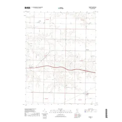
2018 Map of Cameron
USGS Topo · Published 2018About this map
Monmouth serves as the western anchor of this Warren County landscape, where the prairie grid is deeply carved by the drainage of Cedar Creek. The settlement pattern is defined by several rural communities including Gerlaw, Coldbrook, and Cameron, each situated among a network of section-line roads and family-named cemeteries. These burial grounds, such as Gerlaw Cem, Patterson Cem, and Ogden Cem, are scattered across the townships, providing vital points of reference for genealogical research. The transition from the established streets of the city to the winding course of Talbot Cr and Cedar Cr illustrates the relationship between the agricultural plateau and the natural breaks of the terrain. Notable transportation routes like Old US Hwy 34 and Coldbrook Rd trace the path of commerce between these early Illinois settlements.
Find a feature on this map
41 named features on this map. Tap any name to fly to it.
Don’t see what you’re looking for? This feature index may not catch every label — zoom into the map to look around manually.
Map Details
Editions of this 2018 Cameron Map
This is the sole edition of this map. No revisions or reprints were ever made.
Other maps of this area

1921 · Monmouth
USGS Topo · 1:62,500

1923 · Monmouth
USGS Topo · 1:62,500

1923 · Alexis
USGS Topo · 1:62,500

1925 · Alexis
USGS Topo · 1:62,500

1925 · Galesburg
USGS Topo · 1:62,500

1927 · Galesburg
USGS Topo · 1:62,500

1947 · Woodhull
USGS Topo · 1:62,500

1958 · Burlington
USGS Topo · 1:250,000

1958 · Davenport
USGS Topo · 1:250,000

1961 · Burlington
USGS Topo · 1:250,000