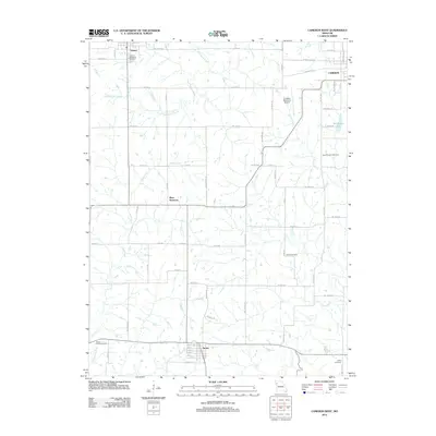
2012 Map of Cameron West
USGS Topo · Published 2012About this map
Osborn and Turney anchor the rural landscape of Clinton and DeKalb counties in this 2012 survey, which illustrates the intersection of small-town centers and the agricultural grid. The map details a region defined by its watercourses, where the Smith Fork and Little Platte River converge in the southwest corner near the Round Prairie Cemetery. The layout of the land is meticulously documented through an extensive network of county roads and named streets, such as McGhee Ln and NE Platte Rd, which connect outlying farms to the established settlements.
Find a feature on this map
46 named features on this map. Tap any name to fly to it.
Don’t see what you’re looking for? This feature index may not catch every label — zoom into the map to look around manually.
Map Details
Editions of this 2012 Cameron West Map
This is the sole edition of this map. No revisions or reprints were ever made.
Other maps of this area

1923 · Maysville
USGS Topo · 1:62,500

1924 · Polo
USGS Topo · 1:62,500

1924 · Winston
USGS Topo · 1:62,500

1925 · Plattsburg
USGS Topo · 1:62,500

1925 · Maysville
USGS Topo · 1:62,500

1950 · Kansas City
USGS Topo · 1:250,000

1954 · Kansas City
USGS Topo · 1:250,000

1956 · Kansas City
USGS Topo · 1:250,000

1960 · Kansas City
USGS Topo · 1:250,000
1983 · Amity
USGS Topo · 1:24,000