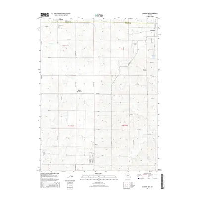
2015 Map of Cameron West
USGS Topo · Published 2015About this map
The boundary between DeKalb and Clinton counties bisects this rural landscape, where the northern edge of Turney and the western reaches of Cameron anchor the local community. This mid-2010s survey captures a geography defined by its cemeteries and agricultural drainage, with several family and community burial grounds like Harlan Cemetery, Saint Mulchin Cemetery, and Round Prairie Cemetery situated among the rolling hills. The small settlement of West Keystone sits at the junction of NE Highway A and NE Keystone Rd, serving as a central point in this transition from the town of Osborn toward the more developed eastern edge. Waterways including Grindstone Creek and Shoal Creek snake through the terrain, while the Cameron Memorial Airport and Burlington Lake provide modern landmarks near the city limits.
Find a feature on this map
43 named features on this map. Tap any name to fly to it.
Don’t see what you’re looking for? This feature index may not catch every label — zoom into the map to look around manually.
Map Details
Editions of this 2015 Cameron West Map
This is the sole edition of this map. No revisions or reprints were ever made.
Other maps of this area

1923 · Maysville
USGS Topo · 1:62,500

1924 · Polo
USGS Topo · 1:62,500

1924 · Winston
USGS Topo · 1:62,500

1925 · Plattsburg
USGS Topo · 1:62,500

1925 · Maysville
USGS Topo · 1:62,500

1950 · Kansas City
USGS Topo · 1:250,000

1954 · Kansas City
USGS Topo · 1:250,000

1956 · Kansas City
USGS Topo · 1:250,000

1960 · Kansas City
USGS Topo · 1:250,000
1983 · Amity
USGS Topo · 1:24,000