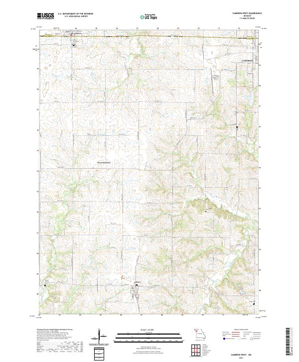
2021 Map of Cameron West
USGS Topo · Published 2021About this map
Osborn and Turney anchor the northern and southern reaches of this agricultural landscape along the border of Clinton and DeKalb Counties. The region is defined by the winding drainages of Grindstone Cr and Smith Fork, which carve through the terrain between the small settlements of West Keystone and the western edge of Cameron. The map reveals a dense network of country roads and local history sites, particularly several well-preserved burial grounds that serve as primary markers of the area's rural heritage. Family and community roots are tied to sites like the Osborn - Evergreen Cem and the Saint Munchin Cem. Toward the east, Burlington Lake and the Cameron Memorial Airport represent more modern infrastructure, yet the overall character remains one of traditional Missouri farmland and dispersed homesteads.
Find a feature on this map
49 named features on this map. Tap any name to fly to it.
Don’t see what you’re looking for? This feature index may not catch every label — zoom into the map to look around manually.
Map Details
Editions of this 2021 Cameron West Map
This is the sole edition of this map. No revisions or reprints were ever made.
Other maps of this area

1923 · Maysville
USGS Topo · 1:62,500

1924 · Polo
USGS Topo · 1:62,500

1924 · Winston
USGS Topo · 1:62,500

1925 · Plattsburg
USGS Topo · 1:62,500

1925 · Maysville
USGS Topo · 1:62,500

1950 · Kansas City
USGS Topo · 1:250,000

1954 · Kansas City
USGS Topo · 1:250,000

1956 · Kansas City
USGS Topo · 1:250,000

1960 · Kansas City
USGS Topo · 1:250,000
1983 · Amity
USGS Topo · 1:24,000