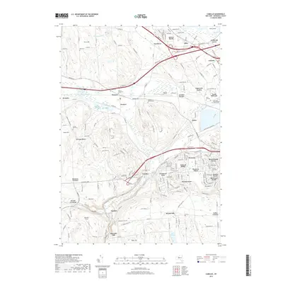
2019 Map of Camillus
USGS Topo · Published 2019About this map
The Old Erie Canal cuts a historical path through this Central New York landscape, running parallel to modern infrastructure near Warners and Newport. The village of Camillus serves as a focal point where Nine Mile Creek winds through the valley, surrounded by established residential developments such as Orchard Village and Winderest Park. The map reveals a high density of local history markers, particularly through its numerous burial grounds like Greenlawn Memorial Park and the Holy Cross Polish National Catholic Cem. To the south, the settlement of Martisco and the Marcellus Airport highlight the area's mix of rural transition and local aviation. The terrain is defined by significant elevations such as Nose Hill and Baker Hill, which rise above the creek beds and the rail corridors utilized by the CSX railroad.
Find a feature on this map
197 named features on this map. Tap any name to fly to it.
Don’t see what you’re looking for? This feature index may not catch every label — zoom into the map to look around manually.
Map Details
Editions of this 2019 Camillus Map
This is the sole edition of this map. No revisions or reprints were ever made.
Other maps of this area

1895 · Syracuse
USGS Topo · 1:62,500

1898 · Syracuse
USGS Topo · 1:62,500

1899 · Skaneateles
USGS Topo · 1:62,500

1900 · Baldwinsville
USGS Topo · 1:62,500

1900 · Tully
USGS Topo · 1:62,500

1902 · Skaneateles
USGS Topo · 1:62,500

1939 · Syracuse West
USGS Topo · 1:24,000

1940 · Brewerton
USGS Topo · 1:24,000

1943 · South Onondaga
USGS Topo · 1:31,680

1943 · Jordan
USGS Topo · 1:31,680