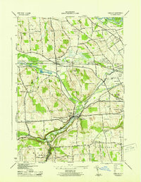
1943 Map of Camillus
USGS Topo · Published 1951About this map
Ninemile Creek carves a deep valley through the center of this landscape, connecting the industrial and agricultural hamlets of Camillus, Martisco, and Marcellus Falls. During the early 1940s, this area west of Syracuse was a critical transportation corridor, defined by the parallel routes of the New York Central Railroad and the Delaware Lackawanna and Western Railroad. The map reveals a transition in water-borne transit, showing the modern Barge Canal alongside segments of the Erie Canal (Abandoned). Evidence of early 20th-century aviation is present at the Syracuse Municipal Airport and a nearby Radio Beacon. Regional history is further preserved through numerous family and community landmarks, from the hilltop Sears Cem on Sorrel Hill to the sprawling grounds of the Syracuse State School. The landscape is dotted with numbered rural schoolhouses, such as School No 9, illustrating the era's local educational infrastructure before district consolidation.
Find a feature on this map
80 named features on this map. Tap any name to fly to it.
Don’t see what you’re looking for? This feature index may not catch every label — zoom into the map to look around manually.
Map Details
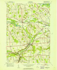
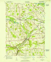
Editions of this 1943 Camillus Map
3 editions found
Other maps of this area

1895 · Syracuse
USGS Topo · 1:62,500

1898 · Syracuse
USGS Topo · 1:62,500

1899 · Skaneateles
USGS Topo · 1:62,500

1900 · Baldwinsville
USGS Topo · 1:62,500

1900 · Tully
USGS Topo · 1:62,500

1902 · Skaneateles
USGS Topo · 1:62,500

1939 · Syracuse West
USGS Topo · 1:24,000

1940 · Brewerton
USGS Topo · 1:24,000

1943 · South Onondaga
USGS Topo · 1:31,680

1943 · Jordan
USGS Topo · 1:31,680