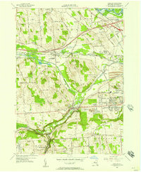
1955 Map of Camillus
USGS Topo · Published 1957About this map
Ninemile Creek carves a deep valley through the Onondaga uplands, serving as a corridor for the New York Central RR and the Old Erie Canal as they pass the industrial and residential hub of Camillus. The mid-1950s landscape shows the transition from rural terrain to suburban development, particularly in the east where housing tracts like Stanley Manor and Westview Manor expand near the Syracuse State School.
Find a feature on this map
116 named features on this map. Tap any name to fly to it.
Don’t see what you’re looking for? This feature index may not catch every label — zoom into the map to look around manually.
Map Details
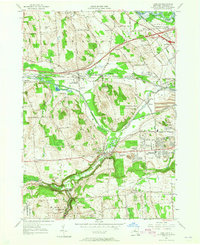
Editions of this 1955 Camillus Map
2 editions found
Other maps of this area

1895 · Syracuse
USGS Topo · 1:62,500

1898 · Syracuse
USGS Topo · 1:62,500

1899 · Skaneateles
USGS Topo · 1:62,500

1900 · Baldwinsville
USGS Topo · 1:62,500

1900 · Tully
USGS Topo · 1:62,500

1902 · Skaneateles
USGS Topo · 1:62,500

1939 · Syracuse West
USGS Topo · 1:24,000

1940 · Brewerton
USGS Topo · 1:24,000

1943 · South Onondaga
USGS Topo · 1:31,680

1943 · Jordan
USGS Topo · 1:31,680