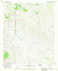
1966 Map of Cammerman Wash
USGS Topo · Published 1968About this map
San Carlos Indian Reservation and the Tonto National Forest meet in this mid-1960s landscape, defined by a network of drainage basins and high peaks. The terrain is dominated by the seasonal paths of Cammerman Wash and Ramboz Wash, which flow south toward the Southern Pacific railroad corridor. Significant geological landmarks including Quartzite Peak and Granite Butte provide verticality to the arid environment.
Find a feature on this map
28 named features on this map. Tap any name to fly to it.
Don’t see what you’re looking for? This feature index may not catch every label — zoom into the map to look around manually.
Map Details
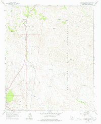
Editions of this 1966 Cammerman Wash Map
2 editions found
Other maps of this area

1901 · Globe
USGS Topo · 1:62,500

1902 · Globe
USGS Topo · 1:62,500

1922 · Chrysotile
USGS Topo · 1:125,000

1945 · Globe
USGS Topo · 1:24,000

1949 · Rockinstraw Mtn
USGS Topo · 1:62,500

1950 · Rockinstraw Mtn
USGS Topo · 1:62,500

1954 · Mesa
USGS Topo · 1:250,000

1957 · Mesa
USGS Topo · 1:250,000

1958 · Mesa
USGS Topo · 1:250,000

1960 · Mesa
USGS Topo · 1:250,000