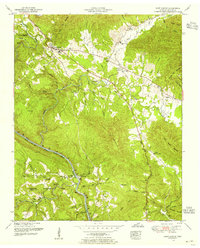
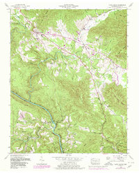
1952 Map of Camp Austin
USGS Topo · Published 1956About this map
The Wartburg community serves as a focal point in this 1952 field revision, situated where the Emory River bends through the valley floor. The landscape is defined by the sharp rise of Lone Mountain and the Cumberland Plateau, with the Southern railroad line following the winding river corridor through Deermont and Camp Austin. A notable institutional presence is the Brushy Mountain State Penal Farm, located in the rugged northeast near Rough Ridge Branch. The map reveals a deeply established social geography, evidenced by numerous small family and community burial grounds such as Summers Cemetery and Honeycutt Cemetery. Remote settlements like Catoosa are accessible via winding roads that cross Crab Orchard Creek, while local education and faith are represented by the Whiteoak School and Mossy Grove Church.
Find a feature on this map
59 named features on this map. Tap any name to fly to it.
Don’t see what you’re looking for? This feature index may not catch every label — zoom into the map to look around manually.
Map Details
Editions of this 1952 Camp Austin Map
5 editions found
Other maps of this area

1887 · Kingston
USGS Topo · 1:125,000

1891 · Kingston
USGS Topo · 1:125,000

1893 · Briceville
USGS Topo · 1:125,000

1893 · Kingston
USGS Topo · 1:125,000

1895 · Wartburg
USGS Topo · 1:125,000

1895 · Loudon
USGS Topo · 1:125,000

1895 · Briceville
USGS Topo · 1:125,000

1896 · Wartburg
USGS Topo · 1:125,000

1896 · Briceville
USGS Topo · 1:125,000

1935 · Gobey
USGS Topo · 1:24,000