1973 Map of Camp Clarke 3 SW
USGS Topo · Published 1975About this map
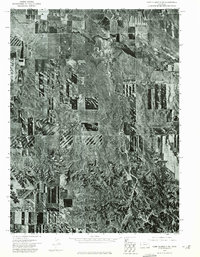
Pumpkin Creek meanders through the northern plains of Banner County in this orthophoto study, which reveals the precise agricultural patterns of western Nebraska during the early 1970s. The aerial perspective distinguishes the cultivated rectangular plots from the eroded, more textured landscape of the breaks to the south. This confluence of drainage systems is dominated by the northward flow of Hackberry Creek, which joins the larger valley floor. Unlike traditional topographic maps, this imagery captures the exact footprints of farmsteads and the fine-grained texture of the prairie vegetation. The contrast between irrigated fields and the semi-arid rangeland provides a clear record of land use and water management in this high-plains environment before more modern center-pivot irrigation systems completely reshaped the local geometry.
Find a feature on this map
2 named features on this map. Tap any name to fly to it.
Don’t see what you’re looking for? This feature index may not catch every label — zoom into the map to look around manually.
Map Details
Editions of this 1973 Camp Clarke 3 SW Map
This is the sole edition of this map. No revisions or reprints were ever made.
Other maps of this area

1898 · Scotts Bluff
USGS Topo · 1:125,000

1898 · Camp Clarke
USGS Topo · 1:125,000

1954 · Scottsbluff
USGS Topo · 1:250,000

1958 · Scottsbluff
USGS Topo · 1:250,000

1965 · South Bayard
USGS Topo · 1:24,000

1965 · McGrew
USGS Topo · 1:24,000

1973 · Scotts Bluff 4 SE
USGS Topo · 1:24,000

1973 · Scotts Bluff 4 NE
USGS Topo · 1:24,000

1973 · Kimball 1 NE
USGS Topo · 1:24,000

1973 · Potter 2 NW
USGS Topo · 1:24,000