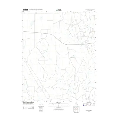
2012 Map of Camp Creek
USGS Topo · Published 2012About this map
The High Plains of Moore County are defined here by the winding drainages of Camp Cr and Big Cr, which carve through the open Panhandle landscape north of the Canadian River valley. During this period in the early 21st century, the map illustrates a sparsely populated ranching environment where large landholdings like the Herring Ranch dominate the terrain. A network of rural transportation routes, including Ranch Road 1923 and Farm-To-Market Road 1923 N, provides the primary framework for movement across these grasslands. The presence of S Bughee and various county roads such as Co RD 4 indicates the managed nature of this agricultural and pastoral expanse, where water sources like Bugbee Cr remain central to the geography of the region.
Find a feature on this map
12 named features on this map. Tap any name to fly to it.
Don’t see what you’re looking for? This feature index may not catch every label — zoom into the map to look around manually.
Map Details
Editions of this 2012 Camp Creek Map
This is the sole edition of this map. No revisions or reprints were ever made.
Other maps of this area

1939 · Sanford
USGS Topo · 1:62,500

1953 · Sanford
USGS Topo · 1:24,000

1953 · Stinnett
USGS Topo · 1:24,000

1953 · Evans Canyon
USGS Topo · 1:24,000

1953 · Pringle
USGS Topo · 1:24,000

1953 · Borger
USGS Topo · 1:24,000

1954 · Amarillo
USGS Topo · 1:250,000

1958 · Amarillo
USGS Topo · 1:250,000
1970 · Sanford
USGS Topo · 1:24,000

1970 · Borger
USGS Topo · 1:24,000