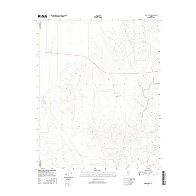
2016 Map of Camp Creek
USGS Topo · Published 2016About this map
The rolling plains of the Texas Panhandle are defined here by the drainage networks of Camp Cr and Big Cr as they cut through the landscape of Moore Co and Hutchinson Co. This terrain, primarily utilized for large-scale ranching and cattle operations, is traversed by a network of rural roads that indicate the area's agricultural foundations. The presence of Herring Ranch Rd and Charles Hart Ln highlights the enduring influence of family-owned ranching tracts in this part of Texas. Modern infrastructure, including Ranch Rd 1319 and FM 687, connects these remote grazing lands to the wider region. In the south, Bugbee Cr flows through the lowlands, illustrating the vital role of seasonal waterways in sustaining the livestock and wildlife of the High Plains.
Find a feature on this map
13 named features on this map. Tap any name to fly to it.
Don’t see what you’re looking for? This feature index may not catch every label — zoom into the map to look around manually.
Map Details
Editions of this 2016 Camp Creek Map
This is the sole edition of this map. No revisions or reprints were ever made.
Other maps of this area

1939 · Sanford
USGS Topo · 1:62,500

1953 · Sanford
USGS Topo · 1:24,000

1953 · Stinnett
USGS Topo · 1:24,000

1953 · Evans Canyon
USGS Topo · 1:24,000

1953 · Pringle
USGS Topo · 1:24,000

1953 · Borger
USGS Topo · 1:24,000

1954 · Amarillo
USGS Topo · 1:250,000

1958 · Amarillo
USGS Topo · 1:250,000
1970 · Sanford
USGS Topo · 1:24,000

1970 · Borger
USGS Topo · 1:24,000