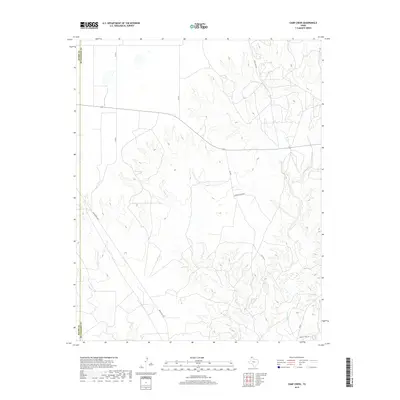
2019 Map of Camp Creek
USGS Topo · Published 2019About this map
The rolling plains of the Texas Panhandle define this landscape along the border of Moore and Hutchinson counties. Modern ranching and transportation infrastructure center on the drainage systems of Camp Cr and the larger Big Creek, which carve deep contours into the high plains. The area is marked by a network of rural roads and highways, including Ranch Rd 1319 and Ranch Rd 1923, facilitating movement across this pastoral terrain. Named landmarks such as Herring Ranch Rd and Charles Hart Ln reflect the local heritage of family-owned landholdings and ranching operations that have long characterized the region's economy and social structure. Near the southern edge of the sheet, the winding path of Bugbee Cr contributes to the complex topography that defines this section of North Texas.
Find a feature on this map
15 named features on this map. Tap any name to fly to it.
Don’t see what you’re looking for? This feature index may not catch every label — zoom into the map to look around manually.
Map Details
Editions of this 2019 Camp Creek Map
This is the sole edition of this map. No revisions or reprints were ever made.
Other maps of this area

1939 · Sanford
USGS Topo · 1:62,500

1953 · Sanford
USGS Topo · 1:24,000

1953 · Stinnett
USGS Topo · 1:24,000

1953 · Evans Canyon
USGS Topo · 1:24,000

1953 · Pringle
USGS Topo · 1:24,000

1953 · Borger
USGS Topo · 1:24,000

1954 · Amarillo
USGS Topo · 1:250,000

1958 · Amarillo
USGS Topo · 1:250,000
1970 · Sanford
USGS Topo · 1:24,000

1970 · Borger
USGS Topo · 1:24,000