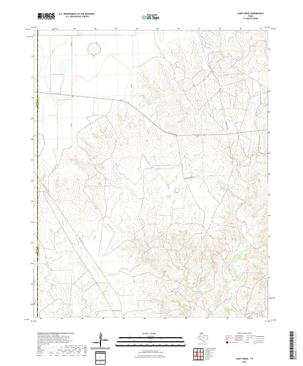
2022 Map of Camp Creek
USGS Topo · Published 2022About this map
The boundary between Moore and Hutchinson Counties runs through this section of the Texas Panhandle, a landscape defined by the drainage networks of several prominent creeks. Camp Creek winds through the central portion of the map, joining other water systems such as Big Creek and Bugbee Creek. This area is characterized by vast rural tracts accessed by a network of ranch roads and county routes. The presence of Herring Ranch Rd and Charles Hart Ln suggests the legacy of family ranching operations and private landholdings that continue to shape the local economy and land use. Modern transportation is facilitated by Fm 687 and Ranch Rd 1923, which provide essential connections across the undulating terrain of these northern plains.
Find a feature on this map
13 named features on this map. Tap any name to fly to it.
Don’t see what you’re looking for? This feature index may not catch every label — zoom into the map to look around manually.
Map Details
Editions of this 2022 Camp Creek Map
This is the sole edition of this map. No revisions or reprints were ever made.
Other maps of this area

1939 · Sanford
USGS Topo · 1:62,500

1953 · Sanford
USGS Topo · 1:24,000

1953 · Stinnett
USGS Topo · 1:24,000

1953 · Evans Canyon
USGS Topo · 1:24,000

1953 · Pringle
USGS Topo · 1:24,000

1953 · Borger
USGS Topo · 1:24,000

1954 · Amarillo
USGS Topo · 1:250,000

1958 · Amarillo
USGS Topo · 1:250,000
1970 · Sanford
USGS Topo · 1:24,000

1970 · Borger
USGS Topo · 1:24,000