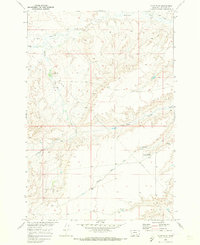
1969 Map of Camp Four
USGS Topo · Published 1973About this map
The settlement of Camp Four sits within a complex network of drainages in Big Horn County, according to this 1969 field-checked survey. The landscape is defined by the significant topographic relief of Squaw Buttes and the high point known as Brink, which overlook the winding paths of Beauvais Creek and Muddy Creek. This survey captures the region just before the early 1970s, illustrating the intersection of natural watercourses like Hay Coulee and South Fork Hay Coulee with modern infrastructure, such as the prominent Pipeline and a network of Jeep Trails. Local resource extraction is noted by a Gravel Pit in the southern portion of the quadrangle, while a Gaging Sta on the upper reaches of Beauvais Creek suggests the ongoing management of the Missouri River Basin's tributaries during this period.
Find a feature on this map
13 named features on this map. Tap any name to fly to it.
Don’t see what you’re looking for? This feature index may not catch every label — zoom into the map to look around manually.
Map Details
Editions of this 1969 Camp Four Map
This is the sole edition of this map. No revisions or reprints were ever made.
Other maps of this area

1893 · Huntley
USGS Topo · 1:125,000

1894 · St. Xavier
USGS Topo · 1:125,000

1894 · Fort Custer
USGS Topo · 1:125,000

1901 · St. Xavier
USGS Topo · 1:125,000

1915 · Spenceville
USGS Topo · 1:31,680

1954 · Billings
USGS Topo · 1:250,000

1954 · Hardin
USGS Topo · 1:250,000

1957 · Hardin
USGS Topo · 1:250,000

1957 · Billings
USGS Topo · 1:250,000

1958 · Billings
USGS Topo · 1:250,000