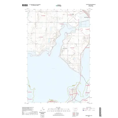
2020 Map of Camp Grafton
USGS Topo · Published 2020About this map
Devils Lake dominates this northern prairie landscape, framing the complex shoreline of Creel Bay and the community of Lakewood Park. This modern survey illustrates the expansive water system and the transportation network serving the region, including the Devils Lake Regional Airport near the northern shore. The map details the transition from rural township sections to developed lakeside areas, with a dense grid of local roads such as Woodland Drive and Eagle Bend Drive reaching toward the water's edge. Further south, the boundary between Ramsey County and Benson County cuts across the lake and the northern edge of Mission Bay, marking the jurisdictional divide in this central North Dakota basin.
Find a feature on this map
49 named features on this map. Tap any name to fly to it.
Don’t see what you’re looking for? This feature index may not catch every label — zoom into the map to look around manually.
Map Details
Editions of this 2020 Camp Grafton Map
This is the sole edition of this map. No revisions or reprints were ever made.
Other maps of this area

1928 · Tokio
USGS Topo · 1:62,500

1931 · Oberon
USGS Topo · 1:62,500

1931 · Tokio
USGS Topo · 1:62,500

1931 · Devils Lake
USGS Topo · 1:62,500

1932 · Grahams Island
USGS Topo · 1:62,500

1950 · Tokio
USGS Topo · 1:24,000

1950 · Grahams Island
USGS Topo · 1:62,500

1950 · Devils Lake
USGS Topo · 1:62,500

1950 · Oberon
USGS Topo · 1:62,500

1951 · Crow Hill
USGS Topo · 1:24,000