
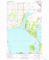
1951 Map of Camp Grafton
USGS Topo · Published 1951About this map
Camp Grafton and the State Military Reservation dominate the peninsula of Rock Island in this early 1950s survey of the western shores of Devils Lake. The map details a landscape shaped by military activity and conservation, where the Sullys Hill National Game Preserve sits at the southern edge of the lake. Transport and local infrastructure are well-documented, showing the path of the Great Northern railway as it passes through Fort Totten Station and travels toward the Municipal Airport.
Find a feature on this map
20 named features on this map. Tap any name to fly to it.
Don’t see what you’re looking for? This feature index may not catch every label — zoom into the map to look around manually.
Map Details
Editions of this 1951 Camp Grafton Map
2 editions found
Other maps of this area

1928 · Tokio
USGS Topo · 1:62,500

1931 · Oberon
USGS Topo · 1:62,500

1931 · Tokio
USGS Topo · 1:62,500

1931 · Devils Lake
USGS Topo · 1:62,500

1932 · Grahams Island
USGS Topo · 1:62,500

1950 · Tokio
USGS Topo · 1:24,000

1950 · Grahams Island
USGS Topo · 1:62,500

1950 · Devils Lake
USGS Topo · 1:62,500

1950 · Oberon
USGS Topo · 1:62,500

1951 · Crow Hill
USGS Topo · 1:24,000