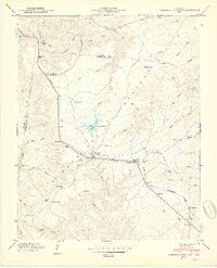
1950 Map of Campbell Junction
USGS Topo · Published 1950About this map
Cumberland Plateau high ground defines this landscape at the boundary of Putnam and Cumberland counties. The Tennessee Central railroad serves as the primary corridor for commerce and travel, connecting small upland settlements like Welch and Mayland. The rail line passes through rugged terrain marked by family-named hollows and landmarks such as Flat Rock Siding and Dripping Springs.
Find a feature on this map
76 named features on this map. Tap any name to fly to it.
Don’t see what you’re looking for? This feature index may not catch every label — zoom into the map to look around manually.
Map Details
Editions of this 1950 Campbell Junction Map
2 editions found
Other maps of this area

1892 · Pikeville
USGS Topo · 1:125,000

1895 · Pikeville
USGS Topo · 1:125,000

1897 · Standingstone
USGS Topo · 1:125,000

1898 · Standingstone
USGS Topo · 1:125,000

1912 · Crossville
USGS Topo · 1:62,500

1935 · Isoline
USGS Topo · 1:24,000

1935 · Campbell Junction
USGS Topo · 1:24,000

1935 · Clarkrange
USGS Topo · 1:24,000
1936 · Crossville
USGS Topo · 1:24,000

1943 · Cookeville
USGS Topo · 1:100,000