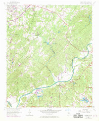
1954 Map of Campbellton
USGS Topo · Published 1969About this map
The Chattahoochee River carves a deep boundary between Douglas and Fulton counties in this mid-century portrait of a rural landscape on the cusp of suburban expansion. Centered on the settlement of Campbellton, the map reveals a network of creek-fed valleys including Anneewakee Creek and Sweetwater Creek. Local life is anchored by country institutions like the Mount Carmel Sch (Cem), Community Grove Ch, and Pleasant Grove Ch, which served established farming communities before the modern road systems fully integrated the area into the metropolitan orbit.
Find a feature on this map
49 named features on this map. Tap any name to fly to it.
Don’t see what you’re looking for? This feature index may not catch every label — zoom into the map to look around manually.
Map Details
Editions of this 1954 Campbellton Map
4 editions found
Other maps of this area

1891 · Marietta
USGS Topo · 1:125,000

1895 · Marietta
USGS Topo · 1:125,000

1897 · Marietta
USGS Topo · 1:125,000

1901 · Marietta
USGS Topo · 1:125,000

1953 · Atlanta
USGS Topo · 1:250,000

1954 · Palmetto
USGS Topo · 1:24,000

1954 · Campbellton
USGS Topo · 1:24,000
1954 · Mableton
USGS Topo · 1:24,000

1954 · Fairburn
USGS Topo · 1:24,000

1954 · Austell
USGS Topo · 1:24,000