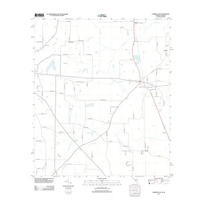
2012 Map of Campbellton
USGS Topo · Published 2012About this map
The State Line between Florida and Alabama defines the northern reach of this landscape, where small rural settlements like Browntown and Rambo are connected by a network of named country roads and lanes. The terrain is characterized by a dense drainage system of creeks and branches, notably Spring Cr and the winding course of Little Alligator Cr. These waterways, along with features like Brantley Pond, suggest a low-lying, well-watered environment that has historically supported local agriculture and small-scale timber interests. In the southeastern portion, the settlement of Jacobs sits at a crossroads, while the Hinson Cem serves as a local genealogical landmark. The presence of Kirkland Airport in the northwest corner adds a layer of modern utility to an otherwise traditional Southern rural landscape where family names like Bowden Hill Rd and Crutchfield Ln are preserved in the local topography.
Find a feature on this map
81 named features on this map. Tap any name to fly to it.
Don’t see what you’re looking for? This feature index may not catch every label — zoom into the map to look around manually.
Map Details
Editions of this 2012 Campbellton Map
This is the sole edition of this map. No revisions or reprints were ever made.
Other maps of this area

1942 · Enterprise
USGS Topo · 1:125,000

1950 · Chipley
USGS Topo · 1:24,000

1951 · Graceville
USGS Topo · 1:24,000

1951 · Chipley
USGS Topo · 1:24,000

1952 · Cottondale East
USGS Topo · 1:24,000

1952 · Campbellton
USGS Topo · 1:24,000

1952 · Cottondale West
USGS Topo · 1:24,000

1952 · Sills
USGS Topo · 1:24,000

1953 · Dothan
USGS Topo · 1:250,000

1954 · Dothan
USGS Topo · 1:250,000