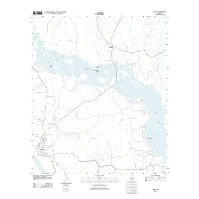
2012 Map of Campti
USGS Topo · Published 2012About this map
Campti and Creston anchor this topographic study of Natchitoches Parish, where the complex waterways of Black Lake dominate the northern landscape. The map details an intricate network of islands and peninsulas, including Pine Island, Bird Island, and Agness Point, set against the sprawling waters of the lake. In the southern portion, the Red River defines the border, while the winding Bourbeaux Bayou and Campti Bayou drain the lowlands. The presence of the Campti Cem and numerous family-named roads like BJ Smith Rd and Ben Gellette Rd provide significant touchpoints for local genealogy. The varied terrain, from the Weaver Slough to the higher ground at Sandy Point, illustrates the historic drainage patterns of this river-and-lake environment in the early 21st century.
Find a feature on this map
83 named features on this map. Tap any name to fly to it.
Don’t see what you’re looking for? This feature index may not catch every label — zoom into the map to look around manually.
Map Details
Editions of this 2012 Campti Map
This is the sole edition of this map. No revisions or reprints were ever made.
Other maps of this area

1937 · Campti NE
USGS Topo · 1:31,680

1937 · Campti SE
USGS Topo · 1:31,680

1937 · Campti NW
USGS Topo · 1:31,680

1937 · Campti SW
USGS Topo · 1:31,680

1944 · Campti
USGS Topo · 1:62,500

1947 · Goldonna
USGS Topo · 1:62,500

1947 · Ashland
USGS Topo · 1:62,500

1948 · Campti
USGS Topo · 1:62,500

1949 · Calvin NW
USGS Topo · 1:31,680

1949 · Calvin SW
USGS Topo · 1:31,680