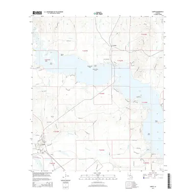
2015 Map of Campti
USGS Topo · Published 2015About this map
Black Lake dominates this Natchitoches Parish landscape, its expansive waters punctuated by numerous named points and islands such as Button Willow Island and Agness Point. The settlement of Creston sits near the northern reaches of the lake, while the town of Campti is situated to the southwest, positioned near the Red River and served by the Kansas City Southern railroad. This map reveals a complex network of waterways, including Campti Bayou and Bourbeaux Bayou, that thread through the lowland areas. A high density of local roads, such as Dan Williams Rd and Ben Gellette Rd, underscores the established rural residency and agricultural patterns of the early 21st century. Genealogists may find particular interest in the location of the Campti Cem, which serves as a central landmark for local family histories in this river-and-lake region.
Find a feature on this map
86 named features on this map. Tap any name to fly to it.
Don’t see what you’re looking for? This feature index may not catch every label — zoom into the map to look around manually.
Map Details
Editions of this 2015 Campti Map
This is the sole edition of this map. No revisions or reprints were ever made.
Other maps of this area

1937 · Campti NE
USGS Topo · 1:31,680

1937 · Campti SE
USGS Topo · 1:31,680

1937 · Campti NW
USGS Topo · 1:31,680

1937 · Campti SW
USGS Topo · 1:31,680

1944 · Campti
USGS Topo · 1:62,500

1947 · Goldonna
USGS Topo · 1:62,500

1947 · Ashland
USGS Topo · 1:62,500

1948 · Campti
USGS Topo · 1:62,500

1949 · Calvin NW
USGS Topo · 1:31,680

1949 · Calvin SW
USGS Topo · 1:31,680