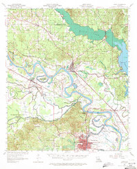
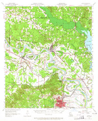
1957 Map of Campti
USGS Topo · Published 1971About this map
The Red River dominates this mid-century landscape as it winds through the alluvial lowlands of Natchitoches and Red River Parish. The complex water system, defined by meandering loops like Old River and Passon Lake, illustrates the historical challenges of settlement along the river's shifting course. While the northern portion is marked by the expansive waters of Black Lake, the southern region centers on the growing footprint of Natchitoches, featuring NW State College and the Radio Tower (KNOC). Transportation corridors follow the terrain's natural contours, with the Kansas City Southern Ry and Texas and Pacific Ry connecting riverfront towns such as Campti and Powhatan. This era shows a dense network of rural community centers, from the Gooch Sch in the Old Spanish Lake Lowlands to the cluster of churches and schools around Lake Bethel and Clarence.
Find a feature on this map
83 named features on this map. Tap any name to fly to it.
Don’t see what you’re looking for? This feature index may not catch every label — zoom into the map to look around manually.
Map Details
Editions of this 1957 Campti Map
5 editions found
Other maps of this area

1935 · Hagewood
USGS Topo · 1:31,680

1937 · Campti NE
USGS Topo · 1:31,680

1937 · Bermuda
USGS Topo · 1:31,680

1937 · Campti SE
USGS Topo · 1:31,680

1937 · Campti NW
USGS Topo · 1:31,680

1937 · Montgomery
USGS Topo · 1:62,500

1937 · Campti SW
USGS Topo · 1:31,680

1938 · Allen
USGS Topo · 1:31,680

1938 · Lake End
USGS Topo · 1:31,680

1942 · Many
USGS Topo · 1:62,500