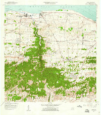
1957 Map of Camuy
USGS Topo · Published 1960About this map
The coastal towns of Camuy and Hatillo anchor this mid-century survey along the north coast of Puerto Rico. The landscape transitions from the shores of the Atlantic Ocean, marked by rocky features like Peñón Brusi and Pta Maracayo, into the densely vegetated limestone hills of the interior. A complex network of local roads and paths, such as Camino de Santa Isabel and Camino del Agua, connects rural barrios including Cienagas, Abra Honda, and Corcovado. The deeply incised channel of the Río Camuy forms a prominent boundary between municipalities. Local life is documented through specific cultural landmarks like the Iglesia Ernesto Memorial, the Escuela Adrián Martínez Gandía, and the unique inland settlement of Radioville, which hosted the Antena de Radio (WMIA) transmitter.
Find a feature on this map
74 named features on this map. Tap any name to fly to it.
Don’t see what you’re looking for? This feature index may not catch every label — zoom into the map to look around manually.
Map Details
Editions of this 1957 Camuy Map
2 editions found
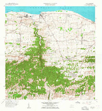
Other maps of this area

1938 · Camuy
USGS Topo · 1:20,000

1938 · San Sebastian
USGS Topo · 1:20,000

1938 · Quebradillas
USGS Topo · 1:20,000

1941 · San Sebastian
USGS Topo · 1:30,000

1942 · Arecibo
USGS Topo · 1:30,000

1942 · Camuy
USGS Topo · 1:30,000

1946 · Utuado
USGS Topo · 1:30,000

1946 · Bayaney
USGS Topo · 1:30,000

1946 · Arecibo
USGS Topo · 1:30,000
1947 · Arecibo SO
USGS Topo · 1:10,000