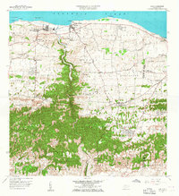
1957 Map of Camuy
USGS Topo · Published 1967About this map
Coastal settlements and agricultural barrios line the Atlantic shore in this mid-century survey of northern Puerto Rico. The town of Camuy sits at the mouth of the Río Camuy, while the neighboring town of Hatillo serves as a local center for utility and industry, including a Planta de Purificación. Inland, the landscape transitions from the coastal plains to the dense, wooded limestone hills of Abra Honda and Buena Vista.
Find a feature on this map
79 named features on this map. Tap any name to fly to it.
Don’t see what you’re looking for? This feature index may not catch every label — zoom into the map to look around manually.
Map Details
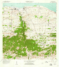
Editions of this 1957 Camuy Map
2 editions found
Other maps of this area

1938 · Camuy
USGS Topo · 1:20,000

1938 · San Sebastian
USGS Topo · 1:20,000

1938 · Quebradillas
USGS Topo · 1:20,000

1941 · San Sebastian
USGS Topo · 1:30,000

1942 · Arecibo
USGS Topo · 1:30,000

1942 · Camuy
USGS Topo · 1:30,000

1946 · Utuado
USGS Topo · 1:30,000

1946 · Bayaney
USGS Topo · 1:30,000

1946 · Arecibo
USGS Topo · 1:30,000
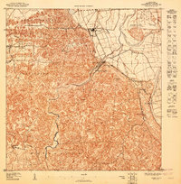
1947 · Arecibo SO
USGS Topo · 1:10,000