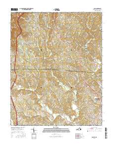
2016 Map of Cana
USGS Topo · Published 2016About this map
Cana sits along the state line where the Piedmont begins its climb toward the Blue Ridge, anchored by a dense network of family cemeteries and rural school sites. The landscape is defined by the winding waters of Pauls Cr and its many tributaries, including Little Pauls Cr and Benson Cr. To the west, the terrain rises sharply toward prominent heights like Sugarloaf and Wheeler Knob, skirted by the high-elevation route of the Blue Ridge Parkway. The map reveals a deeply rooted rural community, evidenced by numerous namesake burial grounds such as the Tolbert-Westmoreland Cem, Marion Jones Cem, and Floyd Edwards Cem. As the terrain descends toward the southern edge of the sheet, it enters the outskirts of Mount Airy near Toast, where the creek valleys broaden into a more developed valley floor.
Find a feature on this map
205 named features on this map. Tap any name to fly to it.
Don’t see what you’re looking for? This feature index may not catch every label — zoom into the map to look around manually.
Map Details
Editions of this 2016 Cana Map
This is the sole edition of this map. No revisions or reprints were ever made.
Other maps of this area

1889 · Hillsville
USGS Topo · 1:125,000

1891 · Yadkinville
USGS Topo · 1:125,000

1892 · Hillsville
USGS Topo · 1:125,000

1893 · Yadkinville
USGS Topo · 1:125,000

1896 · Hillsville
USGS Topo · 1:125,000

1931 · Galax
USGS Topo · 1:48,000

1933 · Galax
USGS Topo · 1:62,500

1953 · Winston-Salem
USGS Topo · 1:250,000

1955 · Winston-Salem
USGS Topo · 1:250,000

1957 · Mount Airy
USGS Topo · 1:62,500