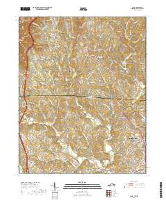
2019 Map of Cana
USGS Topo · Published 2019About this map
Blue Ridge Parkway winds along the western edge of the Blue Ridge Escarpment, overlooking a landscape defined by the drainage basins of Pauls Creek and Stewarts Creek. The boundary between Carroll County, Virginia, and Surry County, North Carolina, bisects the terrain, illustrating how political lines often disregard the natural flow of the Appalachian foothills. This transition from high ridges to the Piedmont plateau is marked by a dense concentration of family and community burial grounds, such as Tolbert-Westmoreland Cemetery and the Floyd Edwards Cemetery, indicating centuries of deep-rooted rural settlement. In the southeastern corner, the outskirts of Mount Airy begin to take shape, showing the shift from the small unincorporated community of Cana toward more concentrated development near City Lake.
Find a feature on this map
204 named features on this map. Tap any name to fly to it.
Don’t see what you’re looking for? This feature index may not catch every label — zoom into the map to look around manually.
Map Details
Editions of this 2019 Cana Map
This is the sole edition of this map. No revisions or reprints were ever made.
Other maps of this area

1889 · Hillsville
USGS Topo · 1:125,000

1891 · Yadkinville
USGS Topo · 1:125,000

1892 · Hillsville
USGS Topo · 1:125,000

1893 · Yadkinville
USGS Topo · 1:125,000

1896 · Hillsville
USGS Topo · 1:125,000

1931 · Galax
USGS Topo · 1:48,000

1933 · Galax
USGS Topo · 1:62,500

1953 · Winston-Salem
USGS Topo · 1:250,000

1955 · Winston-Salem
USGS Topo · 1:250,000

1957 · Mount Airy
USGS Topo · 1:62,500