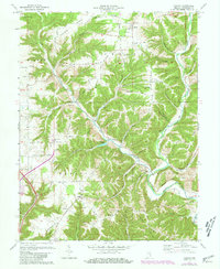
1971 Map of Canaan
USGS Topo · Published 1981About this map
The deeply incised creek valleys of Jefferson County define the landscape of this 1971 revision, where the forks of the West Fork Indian Kentuck Creek and East Fork Indian Kentuck Creek converge. Small farming communities such as Canaan and Manville serve as focal points for the surrounding rural network of ridges and hollows. The area is notable for its numerous country churches and schools that once anchored local life, including Indian Kentucky Ch, Olive Branch Ch, and the Central Sch.
Find a feature on this map
71 named features on this map. Tap any name to fly to it.
Don’t see what you’re looking for? This feature index may not catch every label — zoom into the map to look around manually.
Map Details
Editions of this 1971 Canaan Map
3 editions found
Other maps of this area

1939 · Madison West
USGS Topo · 1:24,000

1943 · Brooksburg
USGS Topo · 1:24,000

1948 · Madison West
USGS Topo · 1:24,000

1953 · Madison West
USGS Topo · 1:24,000

1953 · Carrollton
USGS Topo · 1:24,000

1953 · Madison East
USGS Topo · 1:24,000

1956 · Clifty Falls
USGS Topo · 1:24,000

1956 · Bennington
USGS Topo · 1:24,000

1956 · Canaan
USGS Topo · 1:24,000

1956 · Louisville
USGS Topo · 1:250,000