2002 Map of Canada NW
USGS Topo · Published 2003About this map
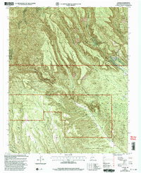
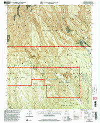
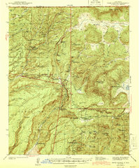
Kasha-Katuwe Tent Rocks National Monument anchors the southeastern landscape of this New Mexico quadrangle, showcasing a geography defined by massive mesas and narrow drainage canyons. The map documents a complex overlay of land management and ancestral territories, including the Jemez Indian Reservation and the Pueblo De Conchiti. Industrial activity is evident through the Pumice Mine and scattered Gravel Pits, situated between the dramatic rises of Horn Mesa and Oaks Mesa. These landforms funnel seasonal waters into Peralta Canyon and Bland Canyon, which cut through the Santa Fe National Forest. High peaks like Bearhead Peak and Cerro Picacho dominate the northern horizons, marking the edges of the Dome Wilderness.
Find a feature on this map
35 named features on this map. Tap any name to fly to it.
Don’t see what you’re looking for? This feature index may not catch every label — zoom into the map to look around manually.
Map Details
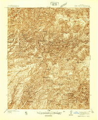
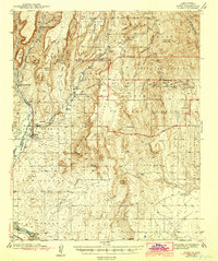
Editions of this 2002 Canada NW Map

Other maps of this area

1890 · Jemes
USGS Topo · 1:125,000

1892 · Jemes
USGS Topo · 1:125,000

1892 · Santa Clara
USGS Topo · 1:125,000
1937 · Jemez Springs
USGS Topo · 1:48,000
1943 · Jemez
USGS Topo · 1:62,500
1944 · Jemez Springs
USGS Topo · 1:62,500
1952 · Jemez Springs
USGS Topo · 1:62,500
1952 · Frijoles
USGS Topo · 1:24,000

1952 · Jemez
USGS Topo · 1:62,500
1953 · Cochiti Dam
USGS Topo · 1:24,000