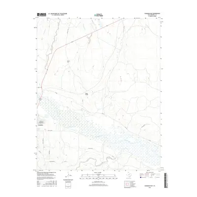
2016 Map of Canadian East
USGS Topo · Published 2016About this map
Canadian serves as the focal point of this Hemphill County landscape, where the wide, braided course of the Canadian River cuts through the Texas Panhandle. The town’s structured streets, including Locust St and 67th St, give way to a sprawling network of ranch and county roads that navigate the surrounding breaks and plains. To the north, Tanner Flat represents the plateaued terrain above the drainage basins of W Fork Clear Cr and Clear Cr.
Find a feature on this map
25 named features on this map. Tap any name to fly to it.
Don’t see what you’re looking for? This feature index may not catch every label — zoom into the map to look around manually.
Map Details
Editions of this 2016 Canadian East Map
This is the sole edition of this map. No revisions or reprints were ever made.
Other maps of this area

1954 · Perryton
USGS Topo · 1:250,000

1954 · Amarillo
USGS Topo · 1:250,000

1958 · Perryton
USGS Topo · 1:250,000

1958 · Amarillo
USGS Topo · 1:250,000

1967 · Mendota
USGS Topo · 1:24,000

1967 · Blue Ridge School
USGS Topo · 1:24,000

1967 · Canadian SE
USGS Topo · 1:24,000

1972 · Canadian West
USGS Topo · 1:24,000

1972 · Canadian East
USGS Topo · 1:24,000

1972 · Glazier
USGS Topo · 1:24,000