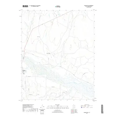
2019 Map of Canadian East
USGS Topo · Published 2019About this map
The Canadian River dominates this landscape, its wide, braided bed carving through the eastern edge of Canadian in Hemphill County. This 2019 survey captures the transition from the town’s residential grid—bounded by streets like Mesquite Rd and Locust St—to the expansive ranchlands of the Texas Panhandle. The sprawling Edith Ford Memorial Cemeteries sit on the southwestern edge of town, serving as a primary site for genealogical research. Beyond the municipal limits, the terrain is defined by dry creek beds and flats, including the prominent Tanner Flat and the winding course of Clear Creek. A network of ranch roads, such as Ranch Rd 1920 and Lake Marvin Rd, provides access to these outlying pastures, where the topography is shaped by the intermittent flows of Elk Creek and W Fork Clear Cr.
Find a feature on this map
24 named features on this map. Tap any name to fly to it.
Don’t see what you’re looking for? This feature index may not catch every label — zoom into the map to look around manually.
Map Details
Editions of this 2019 Canadian East Map
This is the sole edition of this map. No revisions or reprints were ever made.
Other maps of this area

1954 · Perryton
USGS Topo · 1:250,000

1954 · Amarillo
USGS Topo · 1:250,000

1958 · Perryton
USGS Topo · 1:250,000

1958 · Amarillo
USGS Topo · 1:250,000

1967 · Mendota
USGS Topo · 1:24,000

1967 · Blue Ridge School
USGS Topo · 1:24,000

1967 · Canadian SE
USGS Topo · 1:24,000

1972 · Canadian West
USGS Topo · 1:24,000

1972 · Canadian East
USGS Topo · 1:24,000

1972 · Glazier
USGS Topo · 1:24,000