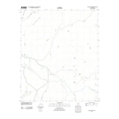
2010 Map of Canador Peak
USGS Topo · Published 2010About this map
Virden sits near the western edge of this New Mexico survey, where agricultural life is defined by the managed flow of the Gila River. The landscape reveals a complex network of irrigation infrastructure essential for high-desert cultivation, specifically the Sunset Canal and the New Model Canal. These waterways parallel the river as it moves toward the Gila Lower Box, supporting local ranching and farming efforts on the Pearson Mesa.
Find a feature on this map
30 named features on this map. Tap any name to fly to it.
Don’t see what you’re looking for? This feature index may not catch every label — zoom into the map to look around manually.
Map Details
Editions of this 2010 Canador Peak Map
This is the sole edition of this map. No revisions or reprints were ever made.
Other maps of this area

1954 · Silver City
USGS Topo · 1:250,000

1958 · Silver City
USGS Topo · 1:250,000

1959 · Steeple Rock
USGS Topo · 1:62,500

1959 · Canador Peak
USGS Topo · 1:62,500

1959 · York Valley
USGS Topo · 1:62,500

1960 · Duncan
USGS Topo · 1:62,500

1962 · Silver City
USGS Topo · 1:250,000
1986 · Duncan
USGS Topo · 1:24,000
1986 · Round Mountain
USGS Topo · 1:24,000
1986 · Goat Camp Spring
USGS Topo · 1:24,000