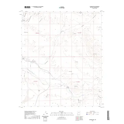
2023 Map of Canador Peak
USGS Topo · Published 2023About this map
Virden serves as the primary settlement in this corner of Hidalgo County, situated where the Gila River enters the valley. The landscape is defined by an intricate network of irrigation, with the Sunset Canal and New Model Canal drawing from the river to support local agriculture. This reliance on the Gila is contrasted by the arid uplands to the north and south, where features like Pearson Mesa and Canador Peak rise above the drainage systems.
Find a feature on this map
42 named features on this map. Tap any name to fly to it.
Don’t see what you’re looking for? This feature index may not catch every label — zoom into the map to look around manually.
Map Details
Editions of this 2023 Canador Peak Map
This is the sole edition of this map. No revisions or reprints were ever made.
Other maps of this area

1954 · Silver City
USGS Topo · 1:250,000

1958 · Silver City
USGS Topo · 1:250,000

1959 · Steeple Rock
USGS Topo · 1:62,500

1959 · Canador Peak
USGS Topo · 1:62,500

1959 · York Valley
USGS Topo · 1:62,500

1960 · Duncan
USGS Topo · 1:62,500

1962 · Silver City
USGS Topo · 1:250,000
1986 · Duncan
USGS Topo · 1:24,000
1986 · Round Mountain
USGS Topo · 1:24,000
1986 · Goat Camp Spring
USGS Topo · 1:24,000