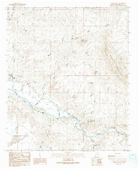
1990 Map of Canador Peak
USGS Topo · Published 1991About this map
The Gila River corridor near the Arizona-New Mexico border defines this landscape, where irrigation infrastructure like the New Model Road and extensive Levee systems support the small settlement of Virden. The transition from the agricultural river valley to the surrounding uplands is marked by significant topographical shifts, rising toward Pearson Mesa and the heights of Black Mountain. This area reveals a history of land use and resource management, including a Landing Strip situated along the valley floor and several scattered water sources such as Mexican Springs Water Tank and Riley Spring.
Find a feature on this map
39 named features on this map. Tap any name to fly to it.
Don’t see what you’re looking for? This feature index may not catch every label — zoom into the map to look around manually.
Map Details
Editions of this 1990 Canador Peak Map
This is the sole edition of this map. No revisions or reprints were ever made.
Other maps of this area

1954 · Silver City
USGS Topo · 1:250,000

1958 · Silver City
USGS Topo · 1:250,000

1959 · Steeple Rock
USGS Topo · 1:62,500

1959 · Canador Peak
USGS Topo · 1:62,500

1959 · York Valley
USGS Topo · 1:62,500

1960 · Duncan
USGS Topo · 1:62,500

1962 · Silver City
USGS Topo · 1:250,000
1986 · Duncan
USGS Topo · 1:24,000
1986 · Round Mountain
USGS Topo · 1:24,000
1986 · Goat Camp Spring
USGS Topo · 1:24,000