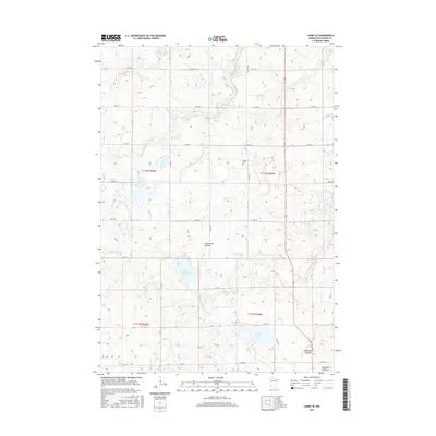
2016 Map of Canby SE
USGS Topo · Published 2016About this map
The Coteau des Prairies plateau dominates this section of Lincoln County, defining a landscape where glacial geography meets a systematic grid of township roads and agricultural drainage. Significant water features include the Yellow Medicine River and the Lac qui Parle River, which drain the uplands alongside engineered channels like Judicial Ditch Number Nineteen. The map reveals the ephemeral nature of the local prairie potholes, identifying the Bukowski Lakebed and Swenson Lakebed as distinct from permanent bodies like Perch Lake and Steep Bank Lake. Local history is anchored by the Marble Cem, situated in the northeastern section of the quadrangle. The intersection of local routes such as Co Rd 18 and Co Hwy 20 provides a clear view of the rural infrastructure supporting this high prairie region.
Find a feature on this map
22 named features on this map. Tap any name to fly to it.
Don’t see what you’re looking for? This feature index may not catch every label — zoom into the map to look around manually.
Map Details
Editions of this 2016 Canby SE Map
This is the sole edition of this map. No revisions or reprints were ever made.
Other maps of this area

1953 · Watertown
USGS Topo · 1:250,000

1958 · Watertown
USGS Topo · 1:250,000

1963 · Arco
USGS Topo · 1:24,000

1967 · Canby
USGS Topo · 1:24,000

1967 · Canby NW
USGS Topo · 1:24,000

1967 · Porter
USGS Topo · 1:24,000
1967 · Porter SW
USGS Topo · 1:24,000

1967 · Lake Benton NW
USGS Topo · 1:24,000

1967 · Canby SE
USGS Topo · 1:24,000

1967 · Hendricks
USGS Topo · 1:24,000