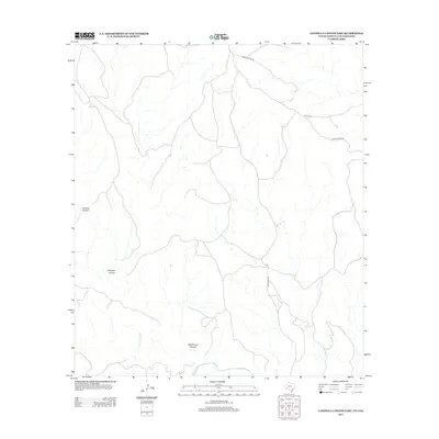
2013 Map of Candilla Canyon East
USGS Topo · Published 2013About this map
The Rio Grande serves as the defining southern boundary of this arid landscape, carving through a region of deep drainages and dry creek beds. The terrain is marked by significant natural features such as Candilla Canyon and Isinglass Canyon, which reveal the erosive power of seasonal waters like Candilla Cr and San Francisco Cr. The sparse road network, including Lower Gatlin Rd and Bone Water Rd, suggests a remote ranching or borderlands environment where travel is dictated by the primary canyons. Further north, Washboard Canyon adds to the complex topography of the area, illustrating the typical high-desert drainage patterns common along the international border in the early 21st century.
Find a feature on this map
9 named features on this map. Tap any name to fly to it.
Don’t see what you’re looking for? This feature index may not catch every label — zoom into the map to look around manually.
Map Details
Editions of this 2013 Candilla Canyon East Map
This is the sole edition of this map. No revisions or reprints were ever made.
Other maps of this area

1918 · Dryden Crossing
USGS Topo · 1:62,500

1918 · Indian Wells
USGS Topo · 1:62,500

1928 · Sanderson
USGS Topo · 1:125,000

1954 · Fort Stockton
USGS Topo · 1:250,000

1958 · Fort Stockton
USGS Topo · 1:250,000

1959 · Emory Peak
USGS Topo · 1:250,000

1965 · Emory Peak
USGS Topo · 1:250,000

1969 · Sanderson SE
USGS Topo · 1:24,000

1969 · Mofeta
USGS Topo · 1:24,000
1969 · Hagler Canyon
USGS Topo · 1:24,000