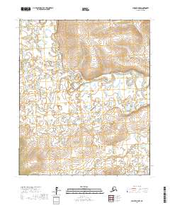
2017 Map of Candle A-6 NW
USGS Topo · Published 2017About this map
Koyuk River meanders across this northern landscape on the Seward Peninsula, exhibiting the complex hydrological patterns typical of the region. The map documents a wilderness terrain defined by its watercourses, where the main river is joined by several smaller tributaries including Copper Cr and June Cr. In the southern portion of the sheet, the drainage network continues with Salmon Cr and its feeder, Flat Cr. This 2017 survey provides an exacting record of the shifting channels and numerous oxbow lakes formed by the river's path through the low-lying interior. There are no marked settlements or industrial developments within these boundaries, leaving a pure topographical study of the natural Alaskan environment as it existed in the early 21st century.
Find a feature on this map
10 named features on this map. Tap any name to fly to it.
Don’t see what you’re looking for? This feature index may not catch every label — zoom into the map to look around manually.
Map Details
Editions of this 2017 Candle A-6 NW Map
This is the sole edition of this map. No revisions or reprints were ever made.
Other maps of this area

1950 · Bendeleben B-1
USGS Topo · 1:63,360

1950 · Bendeleben A-1
USGS Topo · 1:63,360

1950 · Bendeleben
USGS Topo · 1:250,000

1950 · Candle A-6
USGS Topo · 1:63,360

1950 · Candle B-6
USGS Topo · 1:63,360

1951 · Candle
USGS Topo · 1:250,000

1951 · Bendeleben
USGS Topo · 1:250,000

1955 · Candle
USGS Topo · 1:250,000

1964 · Bendeleben
USGS Topo · 1:250,000

1964 · Candle
USGS Topo · 1:250,000