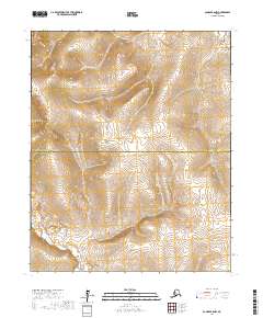
2017 Map of Candle B-6 NW
USGS Topo · Published 2017About this map
The Continental Divide traverses this remote section of the Seward Peninsula, marking the structural spine where waters part toward different Alaskan drainage basins. This high-altitude landscape is defined by its topographic isolation at the boundary between the Northwest Arctic Borough and the Nome Census Area. While human infrastructure is largely absent, the hydrology of the region is anchored by First Chance Cr in the southwest corner. The map documents the vast, uninhabited terrain within the public land survey system blocks of t1n r16w and t1s r16w, providing a detailed view of the natural elevation and watercourses as they existed in the early 21st century.
Find a feature on this map
7 named features on this map. Tap any name to fly to it.
Don’t see what you’re looking for? This feature index may not catch every label — zoom into the map to look around manually.
Map Details
Editions of this 2017 Candle B-6 NW Map
This is the sole edition of this map. No revisions or reprints were ever made.
Other maps of this area

1950 · Bendeleben C-1
USGS Topo · 1:63,360

1950 · Bendeleben B-1
USGS Topo · 1:63,360

1950 · Bendeleben
USGS Topo · 1:250,000

1950 · Candle B-6
USGS Topo · 1:63,360

1950 · Candle C-6
USGS Topo · 1:63,360

1951 · Candle
USGS Topo · 1:250,000

1951 · Bendeleben
USGS Topo · 1:250,000

1955 · Candle
USGS Topo · 1:250,000

1964 · Bendeleben
USGS Topo · 1:250,000

1964 · Candle
USGS Topo · 1:250,000