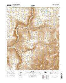
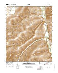
2015 Map of Candle C-1 NW
USGS Topo · Published 2015About this map
Wrench Lake sits as the primary hydrographic feature in this northern interior landscape, situated within a topography of gradual elevation shifts and seasonal drainage patterns. This 2015 survey by the U.S. Geological Survey documents the transition between the public land survey grids of T4n R4w and T4n R3w in the north and T3n R4w and T3n R3w in the south. The absence of permanent settlements or infrastructure highlights the remote character of this region, where the terrain is primarily defined by the contours of the Candle C-1 NW quadrangle. Topographic lines reveal a complex network of ridges and basins that guide the flow toward localized water bodies, reflecting the undisturbed environment of the Yukon-Koyukuk region.
Find a feature on this map
5 named features on this map. Tap any name to fly to it.
Don’t see what you’re looking for? This feature index may not catch every label — zoom into the map to look around manually.
Map Details
Editions of this 2015 Candle C-1 NW Map
This is the sole edition of this map. No revisions or reprints were ever made.
Other maps of this area

1951 · Candle
USGS Topo · 1:250,000

1954 · Candle C-2
USGS Topo · 1:63,360
1954 · Candle D-1
USGS Topo · 1:63,360

1954 · Candle C-1
USGS Topo · 1:63,360

1954 · Candle D-2
USGS Topo · 1:63,360

1955 · Candle
USGS Topo · 1:250,000

1964 · Candle
USGS Topo · 1:250,000
2014 · Candle D-2 SE
USGS Topo · 1:25,000
2015 · Candle D-1 SE
USGS Topo · 1:25,000
2015 · Candle C-1 NE
USGS Topo · 1:25,000