
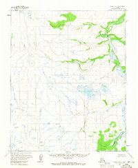
1954 Map of Candle C-1
USGS Topo · Published 1965About this map
The Tagagawik River carves a winding path through the eastern reaches of this remote interior Alaska landscape, defining the drainage patterns for a series of high, unnamed ridges. Photogrammetric methods from the mid-1950s captured this terrain during a period of intense USGS mapping in the territory, revealing a wilderness of tundra and upland peaks. In the northwest, Wrench Lake sits as a significant landmark in a flatter, swamp-filled basin, contrasting with the sharp elevations found further south and east. Named survey points such as Mid, Rock, and Gwen provide fixed triangulation markers across the higher ground, reflecting the meticulous work of the U.S. Geological Survey teams who established these controls before the area saw any modern infrastructure. The map depicts an environment entirely devoid of roads or trails, where the river serves as the primary natural corridor through the hills.
Find a feature on this map
5 named features on this map. Tap any name to fly to it.
Don’t see what you’re looking for? This feature index may not catch every label — zoom into the map to look around manually.
Map Details
Editions of this 1954 Candle C-1 Map
This is the sole edition of this map. No revisions or reprints were ever made.
Other maps of this area

1951 · Candle
USGS Topo · 1:250,000

1951 · Kateel River
USGS Topo · 1:250,000

1954 · Candle C-2
USGS Topo · 1:63,360

1954 · Candle B-2
USGS Topo · 1:63,360
1954 · Candle D-1
USGS Topo · 1:63,360

1954 · Kateel River D-6
USGS Topo · 1:63,360

1954 · Candle D-2
USGS Topo · 1:63,360

1954 · Candle B-1
USGS Topo · 1:63,360

1954 · Kateel River C-6
USGS Topo · 1:63,360
1955 · Kateel River B-6
USGS Topo · 1:63,360